Fat Biking on Ontario’s Park to Park Trail
Mountain biker Bill Farnsworth heads out to discover a new ride in his own back yard.
As a weekend warrior who enjoys getting out on the bike, previously I had ridden several smaller sections of the almost 80km Seguin Trail (a part of the impressive 230 km Park to Park Trail system from Parry Sound to Algonquin Park), but I had always wanted to experience the trail’s entire length in one continuous ride.
 A couple short texts were all it took to convince my friend Rob to join me for the adventure. Knowing that certain sections of the trail were covered in loose, dry sand, Rob suggested we rent fat bikes. Jumping at the chance to finally put some solid kilometres on one of these, I contacted Donnie Collins, bike shop manager at Algonquin Outfitters in Huntsville. Donnie quickly agreed with Rob’s suggestion, saying “…the fat bike, with its extra wide tires, offers the best all-around flotation for trails that are soft and loamy while still offering great handling in normal off road conditions.”
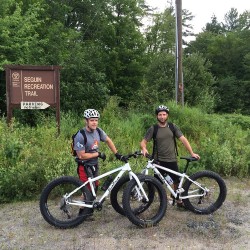
Saturday morning arrived and we loaded my car with our gear, put the bikes on the rack, and Rob’s wife Julia drove us to the western part of the trail, located just off Highway 169 in Parry Sound. The start of the trail is well marked and has ample parking for vehicles and trailers. After taking the obligatory trailhead photo required for future bragging rights, we jumped on our bikes and followed the trail into the forest.
The Seguin Trail runs along the abandoned rail bed of the historic Ottawa, Arnprior and Parry Sound railway. Built by the lumber baron J. R. Booth to move lumber from his mills in the Ottawa Valley to ships travelling the waters of Georgian Bay, the majority of the track was lifted in 1952. The trail is now a multi-use corridor that sees ATV and cycling action in the summer and is a major snowmobile trail in the winter.
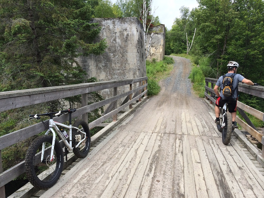
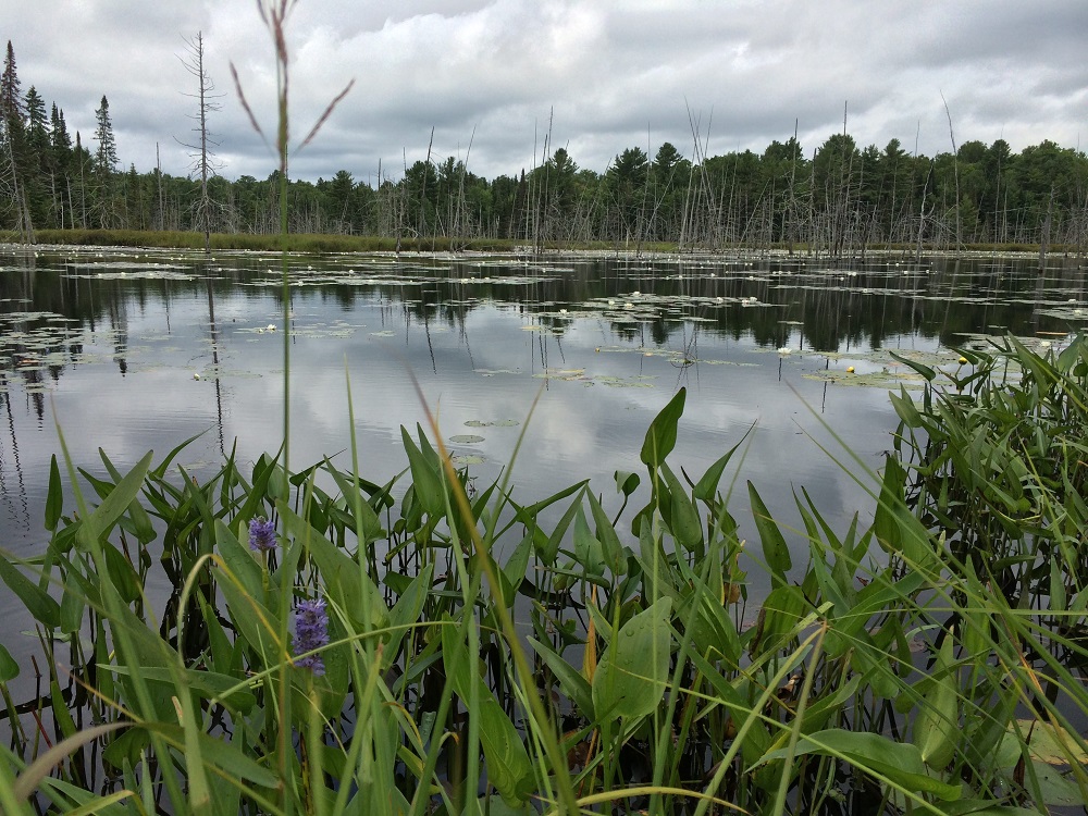
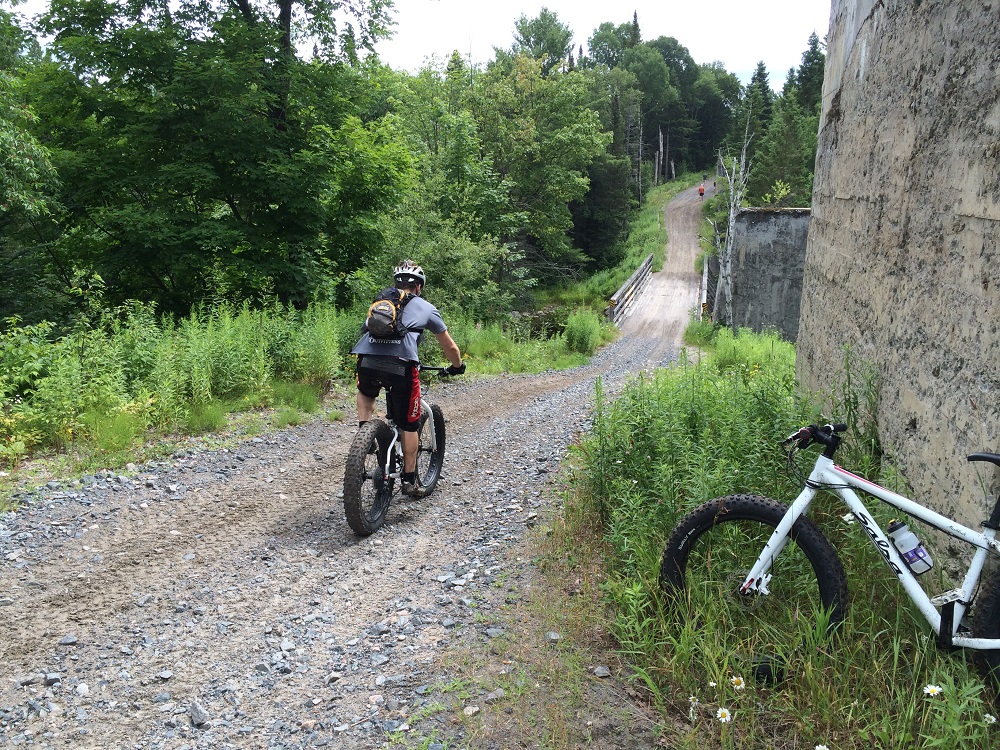 For the first portion of the trail we found ourselves riding through a deciduous tunnel. Here, much of the old rail bed is raised above the natural grade of the surrounding forest, providing a relatively flat and smooth ride. As the kilometres rolled by, I couldn’t help but imagine the size of the undertaking; the clearing and levelling of land, the cutting through rocks and traversing swamps all without most of today’s modern construction equipment. The trail crosses over rivers and wetlands on many man-made bridges. While the original bridges have been replaced by more modern structures to carry the ATV and snowmobile traffic, some still incorporate the original concrete foundations.
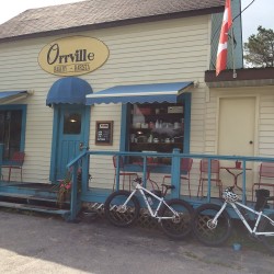 I looked forward to buttertarts and home-baked goodness long before we reached the town of Orrville. The village appeared sooner than expected and we took a well-deserved break at the Orrville Bakery and Barista. With so many treats to choose from, it was difficult but I decided on a delicious chocolate pecan butter tart and a ‘Scotland bar’ served with hand mixed chocolate milk. A nice break and then it was time to get back on the trail.
I knew that somewhere along the route, I would discover several huge concrete pillars left over from an original rail trestle bridge. But I wasn’t truly prepared when, shortly after leaving Orrville, they appeared around a bend in the trail. Towering imposingly over the modern bridge and topped with an unlikely mix of grass and trees, the concrete relics stood guard above the Seguin River below. A few photos, incapable of accurately conveying my sense of wonder at finding these monuments in such remote surroundings, had to suffice.
A little farther down the trail we cross the Old Nipissing Road at the site of the former town of Seguin Falls. The Nipissing Road was a colonization road linking Lake Rosseau and Lake Nipissing. The town of Seguin Falls was built where the road and the railway intersected and, at its peak, had a population of 500 and many buildings and shops including the grand King George Hotel. We took the time to explore and take pictures of the hotel’s overgrown ruins, as well as making a short side trip to see the community’s original schoolhouse, now privately owned.
As we rode closer to the town of Sprucedale, the trail began to open up and the conditions became more sandy and difficult to pedal. I was extremely thankful for the 4 inch width of my bike’s tires as they rolled over sand that would have made pedalling a conventional bike extremely difficult. We witnessed people of all ages travelling the trail, as well as a few dogs enjoying the sights and sounds from the comfort of their owner’s laps. We were now encountering some ATV traffic, and we found the drivers to be respectful of our pedalling and received friendly waves and encouragement as we pressed on.
Just when my stomach was on the verge of outright mutiny, the trail opened up and we found ourselves at The Sprucedale Hotel. With its easy access to the trail, the ‘hotel’ is a popular stop in any season, as evidenced by the number of ATV’s parked in the lot. Despite being surrounded by motorized means of travel, our fat bikes elicited much attention and were the subject of many questions. One enthusiastic patron even complimented us on the speed we were pedalling, noting that we “were really bookin’ it out there!” After enjoying a delicious meal and stretching out my already exhausted legs, it was time to embark on the final leg of our adventure.
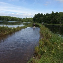 More soft sand and bumps and ruts made for a formidable challenge, as did a knee-deep water crossing. Neither Rob nor I were prepared for the discovery we made while pedalling through what appeared to be a small lake where the trail should be – fat bikes float! The huge volume of air in the tires that made them glide across the sand also caused them to rise to the surface of the water as we lost the occasional battle to rocks hidden under the murky waters. While the water cooled my legs from the heat, soaked shoes seemed to weigh my legs down even more. As I was contemplating the fact that Rob never seemed to tire or even sweat, we finally came to the end of our ride.
The official end of the Seguin Trail comes at the Walls Split, the historical junction between the rail line and the Old Muskoka Colonization Road, which was eventually replaced by Highway 11. Fern Glen Road, just west of Emsdale in the Almaguin Highlands of Ontario marks the modern trail’s eastern terminus. Almost 75 kilometres from where we had started, we had conquered the distance, just as the builders of the railway had so many years before us.
It was a short pedal to the Almaguin Highlands Information Centre where my car was parked, and our great sense of accomplishment was evident. It had taken 6 long hours of riding, but we had successfully completed a bucket list expedition. My mind was dreaming of my next epic adventure in the great Canadian wilderness.
For information on The Seguin Trail, click here. For more information on mountain biking in the great Canadian wilderness, click here. To plan your stay, click here.
 Guest Blogger: Bill Farnsworth
Bill Farnsworth is a freelance writer who has lived in Muskoka for more than 30 years. When not writing, Bill can be found cycling, running, paddling and trying to keep up with his two adventurous boys.
![]()