
Ontario’s Park to Park Trail
Explore the multi-use trail that connects two iconic Ontario parks.
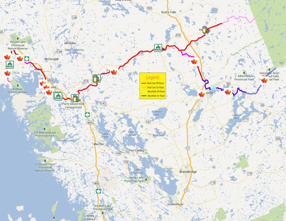
Apart from the incredible natural beauty, the most striking element of the Park to Park Trail is the ground it covers. At 230 kilometers, the trail crosses an area the size of many small European countries. Linking two iconic provincial parks, you can travel from the westerly tip of the Explorers’ Edge region at Killbear Park on Georgian Bay, to its eastern side at the world-famous Algonquin Park.
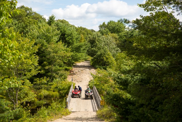 I had the chance to see a good chunk of the route with the man who probably knows the trail better than anyone, Peter Searle, the operations manager for the Park-To-Park Trail Association. Starting off a bit south of Parry Sound, near Highway 400, we rode close to 100 kilometers in a few short hours, cruising north towards Huntsville, then back again.
“Welcome to my office,” says Peter, pointing to a lake where a pair of otters plays in the sparkling water.
 Atop two bright-red ATVs, we followed the trail through incredible country – dense deciduous forests forming tunnels of greenery overhead; open, grassy wetlands, endless lakes and rushing rivers. The section of trail we were on follows the historic route of the Ottawa, Arnprior & Parry Sound Railway. Built by lumber baron J.R. Booth in the 1890s to carry timber south, the railway was once the busiest in Canada, and is partly responsible for the development of Algonquin Park.
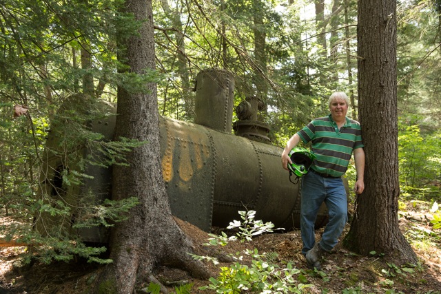
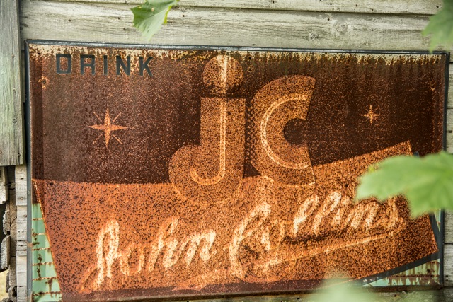 Today, the railway is gone, but signs of it remain if you look closely. The trail sits atop the old rail bed, and along the way there are remnants of the towering trestle bridges, old steam locomotives being slowly consumed by the woods, and most fascinatingly, ruins of formerly thriving towns linked by the railway, including the remains of hotels, post offices and general stores.
“It’s amazing to think that this used to be a busy place,” says Peter. “When you think of the tough lives that these loggers must have lived out here, it makes any of your own problems seem pretty small.”
The Park to Park Trail is open to trail-lovers of all types, from hikers to mountain bikers, ATVers and dirt bikers, and even the occasional rider on horseback. While we were out, we passed several hikers, a few mountain bikers, and a few fisherman off to secret spots along the trail.
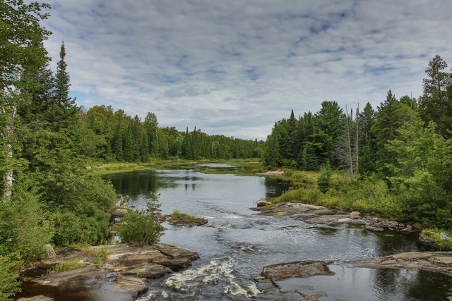 The number of lakes you pass on the trail is astounding. Sometimes it’s easy to think that there is more water than land, and looking at the map it’s impossible to count the lakes. While the trail is free to use for non-motorized users, those on ATVs and trail bikes require passes, which are sold by the day, week or year. With all the users sharing the trail, the regular rules of riding and common sense apply to trail use.
For anyone planning a ride on the Park to Park Trail, your first stop should be www.parktoparktrail.com. This great website can point you towards where to purchase passes; food, fuel and lodging availability, trail maps and more.
One kilometre or one hundred: Get out and explore the incredible journey between two fantastic Ontario parks.
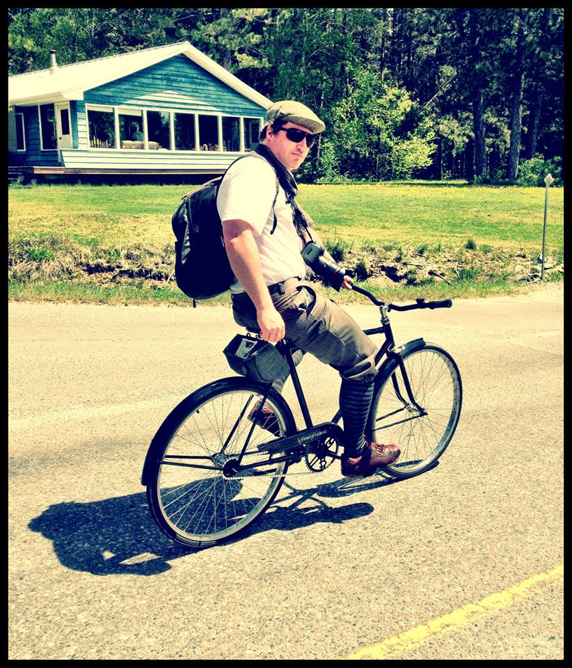 Guest Blogger: Scott Turnbull
Photographer and writer Scott Turnbull lives and works in the region. You can visit Scott and his wife, Miranda Britton, a renowned jewellery designer, at their unique studio in the country near Windermere, Muskoka.
![]()